
Wayfinding
Louisville is adding wayfinding signs to seven primary trails that connect people across the city for transportation and recreation. The signs show routes, distances, trail connections, and nearby destinations.
How wayfinding helps
Consistent trail names, colors, symbols, and maps help residents and visitors navigate Louisville by walking or biking. These signs will help people:
- Follow trail routes
- Understand trail connections
- Find nearby parks and open spaces
- Reach neighborhoods and community destinations
- See distances to key locations
Seven primary trail corridors are planned, with future phases dependent on available funding.
Click on the map to enlarge and explore the trails.
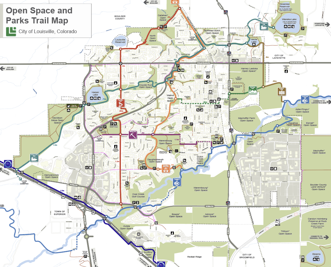
Current Wayfinding Routes

Lake-to-Lake
The Lake-to-Lake route is about five miles long. It connects three cities, four lakes, and six open space properties.
This wayfinding system helps people travel from Harper Lake Open Space toward Waneka Lake in Lafayette.

Powerline Trail
The Lake-to-Lake route is about 2 to 2.3 miles long. It connects Dillon Road to Community Ditch Trail.
This trail is a family-friendly paved path and can be followed in both directions. It is designed with an overall easy grade.
Future Wayfinding Projects